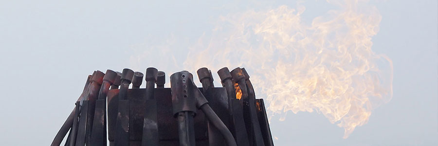
Aerial Robotixs’ unmanned aerial vehicles (drones) are capable of reaching places that are difficult, dangerous, ‘live’, expensive, or even impossible to reach by conventional manned inspection teams. Using our various types of drones Aerial Robotix can inspect both external and internal locations, on/offshore installations and structures in multiple environments. This offers a safe, cost effective…
An impressive product delivered by Aerial Robotix are the virtual 360 degree aerial tours. 360-degree imagery taken from an unmanned aerial vehicle can be combined into a tour in combination with 360 degree imagery from the ground. These panoramic tours are an excellent way of informing visitors of your website about your real estate development,…
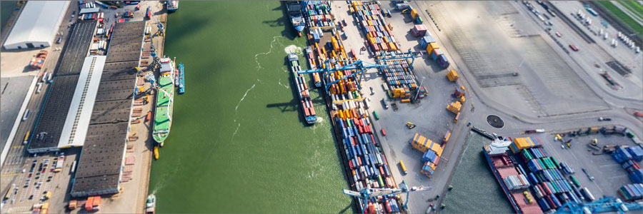
Aerial Robotix(ARX) is specialised in the creation of specialised aerial imagery, in both rural and dense urban areas. Due to our great variety of aerial platforms we will always be able to meet your requirements. Advantages: Ability to operate in controlled airspace We are use to producing high volumes and can offer continuity for each…
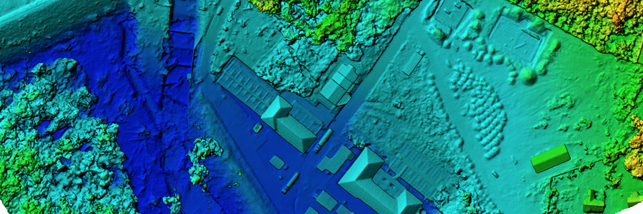
Aerial Robotix uses unmanned aerial vehicles (drones) to carry out aerial surveys and mapping. We accomplish this by combining low altitude aerial photography with geometrically calibrated cameras and a technique called photogrammetry. With the captured data, we then create Orthophoto mosaics, 3D digital elevation and terrain models. Using a drone for aerial survey and mapping…
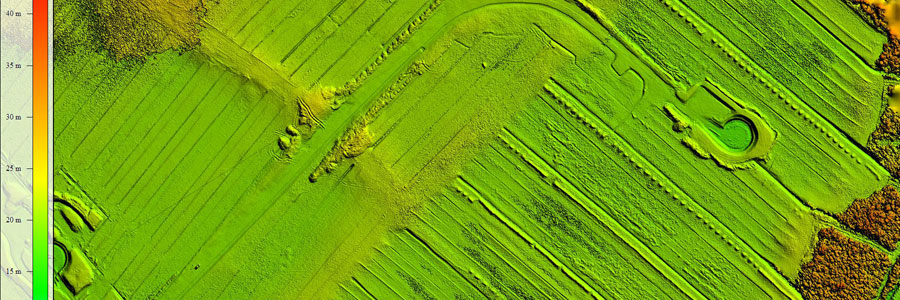
Aerial Robotix(ARX) is specialised in low altitude aerial photography with a geometrically calibrated camera. This enables us to obtain all heights of a surveyed terrain. At the location of each extracted height the X and Y coordinates are also measured. Using this data, a digital terrain model (DTM) is created. The advantages of a digital…
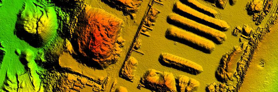
Aerial Robotix is specialised in highly accurate surveys of stockpiles using to unmanned aerial vehicles(UAVs). Our UAVs are equipped with a high-resolution digital camera (36 Mp) that has been geometrically calibrated to perform measurements. The measurements are based on the principle of photogrammetry whereby terrain heights are extracted from a series of overlapping images. This…
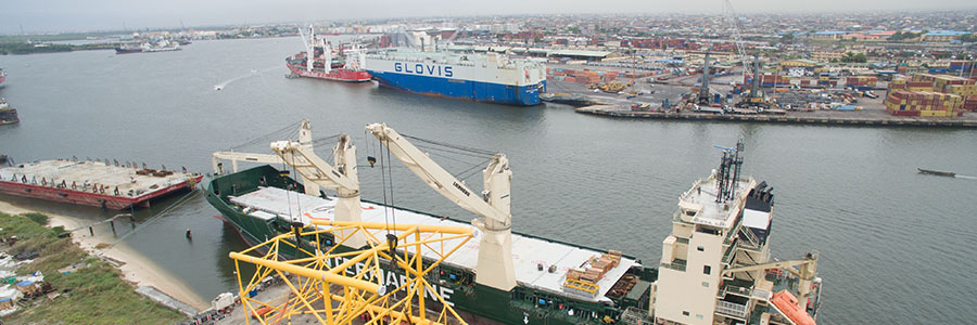
Aerial Robotix(ARX) uses unmanned aerial vehicles (Drones) to produce aerial photography at low altitude. This enables us to act safely, efficiently in a cost saving manner. The low altitude flights yield unique and very high resolution imagery in which every detail can be seen. By using a geometrically calibrated camera and lens along with additional…