Pipeline Survey Nigeria
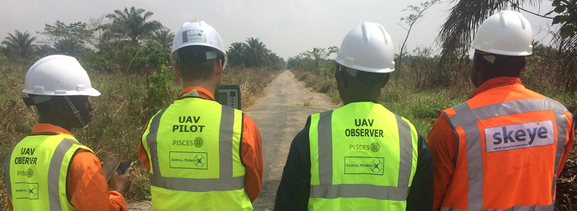
Aerial-Robotix and Skeye have recently executed a successful project in the Niger Delta region of Nigeria. The aim of the project was to perform an aerial survey of a 20 kilometer plus corridor for a new to be build pipeline. The end client was a large oil and gas operator in Nigeria.
The most challenging part of the survey was obtaining the flight permissions from the Nigerian Civil Aviation Authorities. Aerial-Robotix, Skeye’s exclusive partner for the Nigerian market managed to obtain all the required documentation and to get future operations fully certified. The team in the field consisted of one Skeye pilot/surveyor complemented by one surveyor and one observer from Aerial-Robotix.
The project took place over a period of seven days. The Trimble UX5-HP fixed wing drone was used to capture aerial images at a height of 400 feet resulting in a ground resolution of 2 cm. From the overlapping images a full 3D digital elevation model (DEM) and a 3D digital terrain model were produced using photogrammetry. In addition, one seamless aerial image was created out of the thousands of images taken whereby the final orthophoto mosaic was corrected for color, scale and height differences.